Kamal Ewida Earth Observatory (KEEO)
NATO Science for Peace and Security Program is funding the development of the Kamal Ewida Earth Observatory for proactive vulnerability assessment, early warning, time-critical event monitoring, disaster mitigation, humanitarian relief, emergency response, and facilitation of post calamity reconstruction. The project is a collaboration among faculty from Purdue University, USA, Cairo University, Egypt, Al Azhar University, Egypt, and Bogaziçi University, Turkey
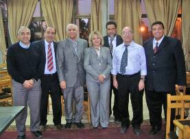
The KEEO Team, right to left: M.Shokr (Environment Canada), Magdy Wahab (PPD-Cairo U.), M. Atef (Aero/Astro-Cairo U.), Gülay Altay (KOERI), G.Rochon (NPD-Purdue U.), Okan Ersoy (Purdue U.), Gamal El Afandi(COO-Al Azhar U.)
The Observatory will largely recreate Purdue University's Terrestrial Observatory, part of Purdue's Rosen Center for Advanced Computing, and its remote sensing and analysis capabilities in Cairo, Egypt. Moreover, faculties at Cairo University and Al Azhar University will have access to the real-time and archival data and associated analytical software to support multi-disciplinary scientific research addressing disaster mitigation, best disaster management practices, environmental sustainability and sustainable development, short-term training for ministerial staff and student instruction, with an emphasis on incorporating remote sensing fundamentals and applications (especially for disaster management), and real-time data management within the curricula for the purpose of preparing the next generation of technologically fluent researchers and decision makers.
Remote Sensing for Potential Disease Outbreaks and Control
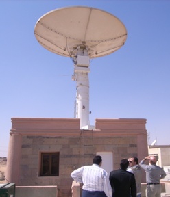
Egypt's National Authority for Remote Sensing & Space Sciences (NARSS) Remote Sensing Groundstation at Aswan, Egypt
Among the many functions of the Kamal Ewida Earth Observatory remote sensing facility is the ability to allow researchers to monitor disease outbreak potential, as well as to study a variety of vector-borne diseases.
It is increasingly possible to develop and provide effective products, services, and tools to the emergency management community as new remote-sensing data and geographic information system (GIS) technology becomes available. GIS has provided decision support products and services to assist in all four phases of disaster management: mitigation, preparation, response, and recovery.
Epidemics such as meningococcal meningitis in Africa have plagued the continent for over a century. Since the epidemics have a strong association with the environment, efforts are being made to develop models to predict both their location and their incidence based on the environmental information available.
Epidemiologists are implementing new remote-sensing techniques to study a variety of vector-borne diseases. They review the status of remote-sensing studies of arthropod vector-borne diseases due to mosquitoes, ticks, blackflies, tsetse flies, and sandflies, which are responsible for the majority of vector-borne diseases in the world. In their study, associations between satellite-derived environmental variables such as temperature, humidity, and land cover type and vector density are used to identify and characterize vector habitats. The availability of multi-temporal satellite data and georeferenced epidemiological data, collaboration between remote-sensing scientists and biologists, and the availability of sophisticated statistical geographic information system and image processing algorithms create a fertile research environment.
For example, in Senegal during the rainy season the abundance of mosquitoes over the Ferlo region is linked to vegetation cover and turbidity of temporary and relatively small ponds. The latter creates a variable environment where mosquitoes can thrive and thus contribute to diffusion and transmission of diseases. Remote sensing is also used in identifying anopheline mosquito larval habitats in western Kenya highlands by modeling the digital elevation model and landuse types of aquatic habitats and habitats with Anopheles larvae.
Bacterial disease outbreaks such as cholera directly or indirectly depend on such conditions as water temperature, nutrient concentration, and plankton production that may be favorable for growth and reproduction of the bacterium. Although environmental parameters have routinely been measured by using water samples collected aboard research ships, the available data sets are sparse, infrequent, expensive and time consuming and interpolation to regional scales can be problematic as well. Remotely sensed data can be used to infer the presence of bacteria that cause disease by sensing it indirectly. In one study, satellite data were used to monitor the timing and spread of cholera. Public-domain remote-sensing data for the Bay of Bengal were compared directly with cholera case data collected in Bangladesh from1992 to 1995. It was discovered that sea surface temperature shows an annual cycle similar to the cholera case data. Studies showed that cholera epidemics are climate linked.
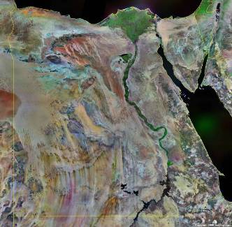
Egypt from space
The remotely sensed data will be used for the development of early warning systems in a changing climate and environment. Geographic distribution of vector-borne diseases and other types of disease are mostly determined by environmental factors. Increased availability of near real-time daily weather data derived from remote sensing should permit proactive vulnerability assessment, early warning, improved time-critical event monitoring, disaster mitigation, humanitarian relief, emergency response, and facilitation of post calamity reconstruction
View a presentation on the Real-Time Remote Sensing for Early Warning & Mitigation of Disasters & Epidemics: The Kamal Ewida Earth Observatory (KEEO) 
